• Landscape Photography
  • Commercial Photography
  • Prints
  • About Me
  • Blog
Menu

James Griffiths Photography

I like to take pictures sometimes
  • Landscape Photography
  • Commercial Photography
  • Prints
  • About Me
  • Blog
×
2018-005.jpg

The Grand Staircase-Escalante National Monument

The Grand Staircase-Escalante is a large National Monument in southern Utah. It was originally established in 1996 by President Bill Clinton as a 1,880,461 acre monument managed by the Bureau of Land Management (BLM,).

Read More

Grand Staircase-Escalante National Monument

James Griffiths June 8, 2018
Outside of Paria

Outside of Paria

The Grand Staircase-Escalante is a large National Monument in southern Utah. It was originally established in 1996 by President Bill Clinton as a 1,880,461 acre monument managed by the Bureau of Land Management (BLM,). In 2017 President Donald Trump reduced the size of the monument to 1,003,863 acres. There are 3 distinct areas of the monument, the Grand Staircase, Kaiparowits, and Escalante Canyon. It's one of the more diverse monuments and is most often characterized by it's colorful cliffs, slot canyons, and various desert monoliths.

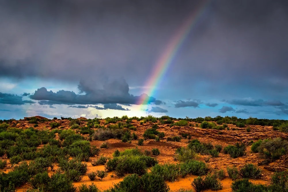
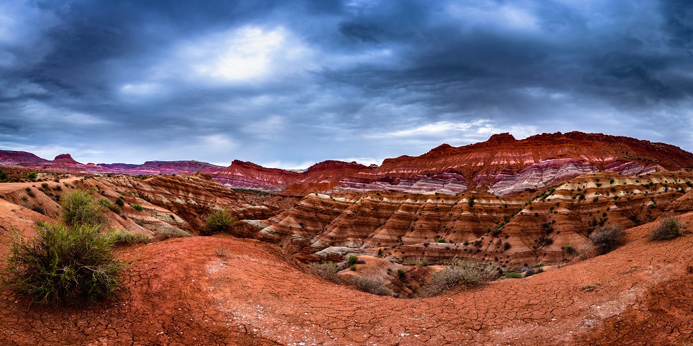
I went there for the first time in March 2017 and spent some time in the Paria area, which is basically this road leading to the remains of a ghost town. I thought it would actually be a ghost town with buildings and what not but it's really just some markers of where the town used to be, although the graveyard is still there. The easily definable layers in the cliffs and the vast stretches of the plateaus and mesas in this area give a clear view of the staircase that gives the monument it's name. You can see an image I captured from just off the road here on the top of this post. And keep in mind this "road" is not for the faint of heart. It seems like a normal dirt road when you first start out but around a particular corner the you'll find yourself driving on the top of these cliffs that drop off on either side. It's really not as bad as it feels once you step out of the car though, and in my opinion the best views are from the side of this road.
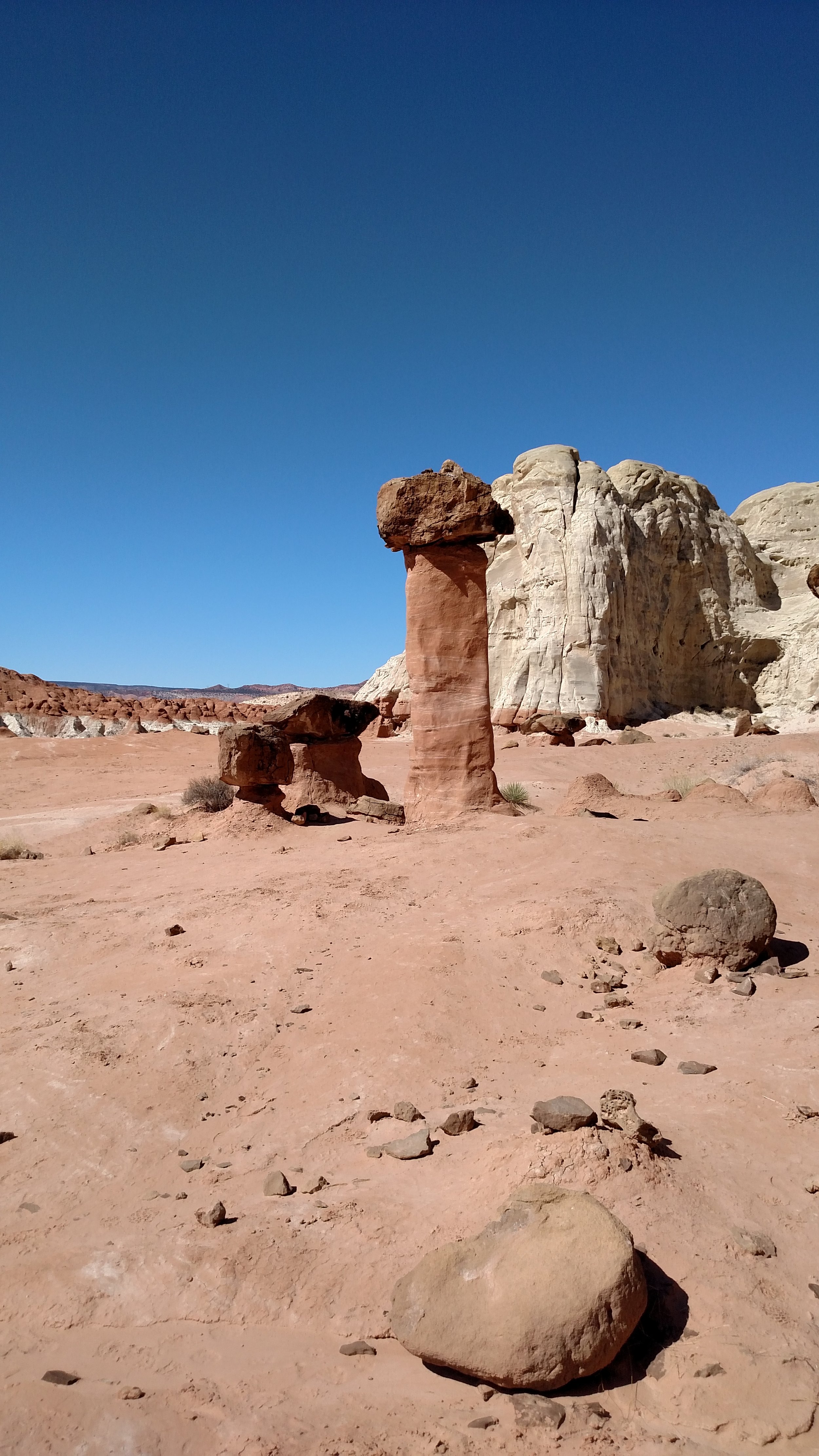
Toadstool Hoodoos

Toadstool Hoodoos

I was back in the staircase almost exactly one year later (this past March) and hiked into the famous Toadstool Hoodoos. This is one of the more surreal places in the area in my opinion. It's maybe a mile hike into the back area where you reach a plateau lined with cliffs and these odd shaped monoliths jutting out all over it.

IMG_20180319_115834827.jpg
LRM_EXPORT_20180319_143531.jpg
LRM_EXPORT_20180319_143737.jpg

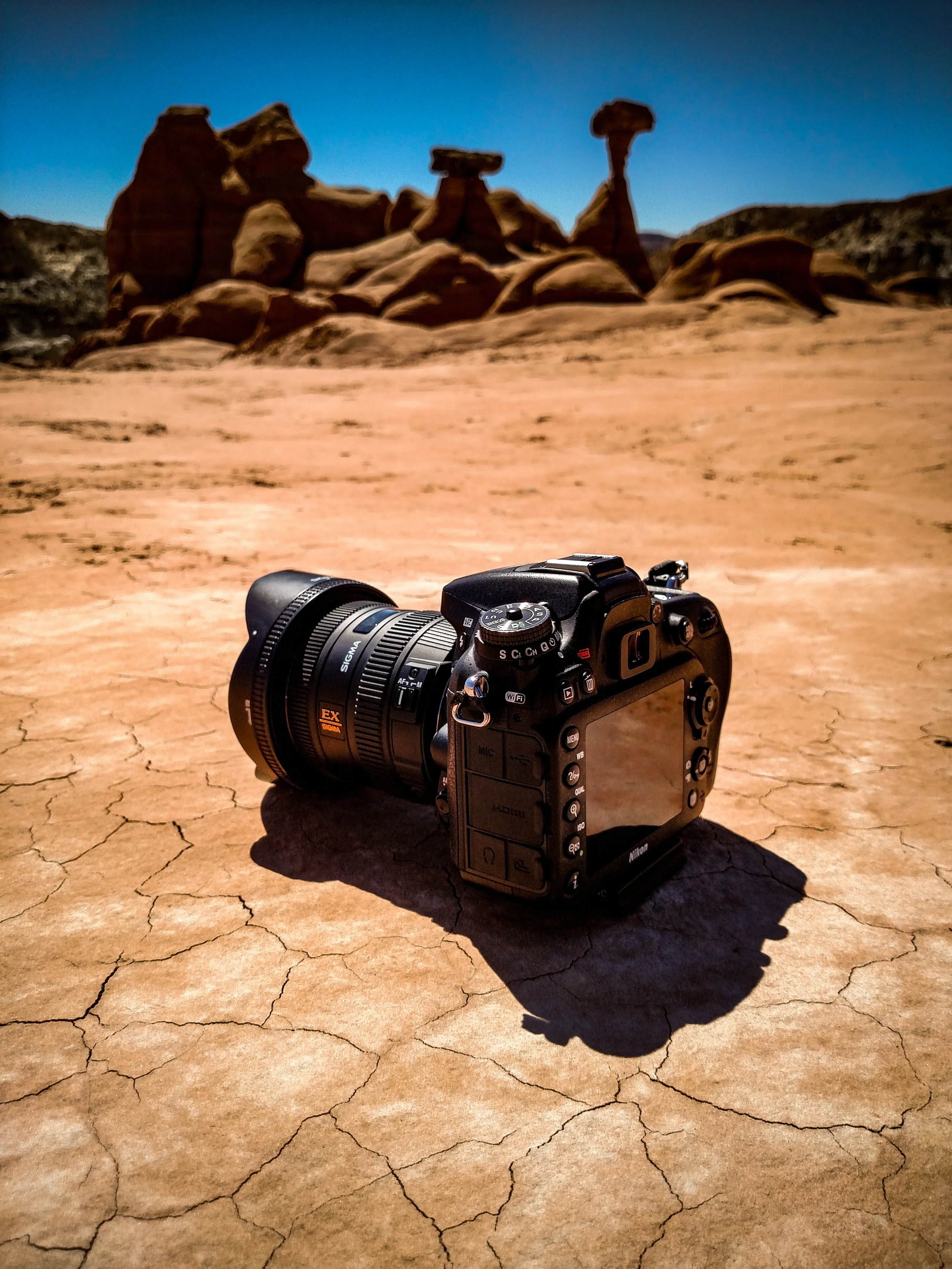
The hike isn't all too strenuous, but does require you to either not mind walking on a one foot wide path with a 30 foot drop on either side or find a way to climb up a 5-10 foot cliff. Either way being there is definitely worth it.

That's all I've seen so far of this monument, I'll just keep chipping away at seeing little pieces of it. The small sections I have seen are definitely worth a visit though.

My National Park & Monument List

In Parks & Monuments, Travel, US Southwest
Comment
2018_001.jpg

2017 In Review

This is a little late, January kind of got away from me, but I wanted to share a recap of my year. This was the first full year that I've really focused on improving my photography, before this point I was a very casual photographer often going months at a time without even picking up my camera.

Read More

2017 In Review

James Griffiths January 20, 2018
"Lake Crescent" - Washington State

"Lake Crescent" - Washington State

This is a little late, January kind of got away from me, but I wanted to share a recap of my year. This was the first full year that I've really focused on improving my photography, before this point I was a very casual photographer often going months at a time without even picking up my camera. It was in the fall of 2016 that I realized how therapeutic it can be through the entire creative process, and it quickly grew from a casual hobby to something of a passion. I also have done more traveling this past year than I ever have before. I've been to 32 states (14 of which I'd never been to before) and spent 59 nights away. It's particularly been interesting since I quit my job last may to focus on myself and my own projects (both with photography and programming). So I thought I'd go through this past year month by month using my favorite photos from each month (when they were taken not necessarily when they were posted) as the subjects.

January
The photo for this month is at the top of this post. Kind of fitting because I think it's still my favorite photo of the year (or at least a close runner up). I'd wanted a photo like this for a while, a cool lake leading up to a snow capped mountain, and I finally saw it with the waning sunlight hitting the peak while driving through Olympic National Park in Washington State with my sister. We were in the Seattle area for a long weekend and made the most of the time there, but this was actually taken only a few hours after landing in Sea-Tac.


"Stuck" - Long Island

"Stuck" - Long Island

February
This month spent a few days up at my parent's cabin in Upstate New York, but was home for the most part. I love the island I live on, mountains and deserts are amazing but there's no comparison for an ocean sunset (or in this case a bay sunset - close enough). This was taken a few hours after a snowfall stopped in early February. The names I choose for the photos I share are usually either the name of the place or some combination of the way I was feeling when taking the photo along with how the photo makes me feel. For instance this one is called "Stuck" because it was at a point in my life when I was feeling kind of trapped, I wanted to do something more meaningful with my life but hadn't figured out what yet and didn't think I could quit my job to figure it all out (which is what I wanted to do). You can also kind of see it in the way the overcast sky traps the colors of the sunset at the horizon, yet the pinks and purples still manage to push past that barrier. It's also called this because I had accidentally driven my car off the parking lot pavement and into the sand (it was all covered in snow) and literally had to get my car unstuck after I took this photo.


"Arizona Rain" - Arizona

"Arizona Rain" - Arizona

"Horseshoe Bend" - Arizona

"Horseshoe Bend" - Arizona

March
This month I went to the Southwest for the first time with my father. It has since become my favorite part of the country. I've wanted to go to Horseshoe Bend for years, so it was a kind of surreal experience finally being there. I'm showing two photos from this month because they kind of go together. It was drizzling on and off on the walk to the edge of the canyon and for a few minutes a rainbow appeared. I was glad I had my camera out at the time because it was gone a moment after I took that shot. Then I was at the edge, where I found a good spot and waited there for nearly an hour while the light changed to make sure I wouldn't lose this key spot - It was a Saturday night and it does get pretty crowded there that time of day. 


April
I realized when going through the photos for this post that I never posted anything I took in April. I had taken a few but nothing all that interesting and I was probably more involved with going through my photos from my southwest trip at the time. I had also given in my two weeks notice to my job in the middle of this month so I was focused on finalizing things there. I did spend another weekend up at my parent's cabin with some friends (I go there several times a year because it's a really convenient getaway). 


"Open Up" - Tennessee

"Open Up" - Tennessee

"All I Want" - Tennessee

"All I Want" - Tennessee

May
I have two photos again because they were taken at the same place, and although my favorite is the first one the second one was much more popular on social media. I still like both but I think it's interesting when a photo I love isn't as well received as one I thought was good, but not as good. I was in Tennessee for my sister's graduation staying at this cabin. The first photo I planned the night before, rolled out of bed before sunrise, opened the window, and took the shot. Then I went back to bed. The next one I just wanted a cool glowing cabin night shot and the moon happened to be in the perfect spot to make a "moon-star" - I guess. My last day at my job was the day I left to come here, so it felt like the start of something new and that's kind of the feeling I had when taking these. The very end of this month was when I began my road trip around the country. 


"The Yellowstone River" - Yellowstone National Park

"The Yellowstone River" - Yellowstone National Park

"Mount Shasta" - California

"Mount Shasta" - California

"All In" - Tennessee

"All In" - Tennessee

June
This month is difficult to choose my favorite or best photos for, most months are to some degree, but I spent so much time driving around the country and taking photos nearly every day. The first image here is from Yellowstone National Park, a multi-shot long exposure of the Yellowstone River that I took my first time seeing it. It ended up being one of my most popular photos on social media in 2017. The second image is of Mount Shasta in northern California. I was driving around this mountain for nearly an hour on my way to San Francisco and as the light was getting better I decided that I had to stop and find a composition for it. I'm really happy with how it turned out especially being it was unplanned and from the side of the road. The third image is from Tennessee towards the end of my trip. I didn't expect one of my favorite images from this trip to be from the same half of the country I live on, but it was. I love the smooth waterfall and reflections creating those leading lines, and it was just a nice picture to close out my trip (I think this was basically the last one I took). 


"Golden" - Long Island

"Golden" - Long Island

July
I stayed home for most of the summer after I got back from my cross country trip. I drove for Uber for a while to make a little extra cash but wanted to focus most of my energy on photography and some programming ideas. This image was from the north shore of Long Island in the early part of the month. Just a simple golden sunset, kind of the way I'm feeling at this point. 


"Anew" - Long Island

"Anew" - Long Island

August
I love this shot, it's of the Fire Island Lighthouse about 10 minutes from my home. Lighthouses to me have a powerful yet calming feeling to them, guarding  the sea. I've shot this one several times, but this was the first time I planned out a trip there before sunrise to this particular beach. I like to incorporate little details in my images that you might not notice at first glance whenever I can. In this one you can see the moon directly above the lighthouse, it's very small here because I'm using a wide angle lens but it's presence adds a bit of depth to the image.


"Plans" - Stamford, NY

"Plans" - Stamford, NY

September
By September I was getting the urge to go somewhere, and that somewhere was once again my parent's cabin (on my way up to Maine). A few miles away on top of Mount Utsayantha I got this image. I've been to the top of that mountain several times but this was the first time at sunset. After a few days there I left for Maine, but that was technically in October.


"The Blue Hour" - Maine

"The Blue Hour" - Maine

"Ebb" - Acadia National Park

"Ebb" - Acadia National Park

October
Here I am in Maine, or rather here are 2 pictures I really like that I took in Maine. The first one was just outside Baxter State Park on my way back to a hotel. I was trying to get a shot of a full moon that was setting but by the time I found a good spot to pull over it was gone, and this was there. Even though I've seen a lot of similar images I didn't want that to stop me from trying one out myself. The next image is from Acadia National Park, this was one of my favorite parts of the park, Otter Point I think, that I had scouted out in the afternoon. The rock I'm standing on felt much more precarious when I came back around sunset to shoot this, but it was worth it.


"Watkins Glen" - Watkins Glen, NY

"Watkins Glen" - Watkins Glen, NY

November
So this is in the Finger Lakes Region of New York. I never really think to explore other parts of New York because I live here, but that can be a mistake. There are some really awesome things to see around in my home state. I spent a few nights again at my parent's cabin (for a total of 4 times this year) and then set off for a couple of days chasing waterfalls. I love this particular image because it feels so much different than most of the others I've taken and I think it really captures the mood of the place. It worked out pretty well because the path in this photo is closed at that time of year so I was forced to take the path overlooking it. If that hadn't happened I wouldn't have seen this.


"Follow" - Long Island

"Follow" - Long Island

December
The last month of the year and the only photo I posted that was actually taken in December. I came here specifically for a shot involving that concrete wall thingy but the scene had changed a lot from what I remembered. I was happy with the composition I ended up with, and the contrast between the snow and that red algae (at least I'm pretty sure that's algae) was really cool. I honestly almost didn't share it because the focus is slightly off from where I wanted it to be and I didn't realize that when I was there. I'm starting to learn to be okay with minor imperfections as long as it works as a whole.

It was a great year for me, in fact I can pretty easily say this was my best year yet. I've done a lot of things that I've wanted to for a very long time, and I've never felt better about the path my life is on now. Thank you all for the support, and have a great 2018!

I'm starting to sell prints of some of my images, currently 5 of them shown here are available on my website here. If there are others you are interested in please let me know.

In Travel, Cross Country, US Midwest, US Northeast, US Northwest, US South, US Southwest, US West
Comment
cross_country_2017_p5.jpg

My 10,000 Mile Journey, or A Cross Country Trip in Selfies - Part 5

Today was the first full day travelling with my Dad. We left Denver in the morning and drove over to Estes Park.

Read More

My 10,000 Mile Journey, or A Cross Country Trip in Selfies - Part 5

James Griffiths July 24, 2017
t-7506.jpg

Day 21 - Monday June 19th: Today was the first full day travelling with my Dad. We left Denver in the morning and drove over to Estes Park. After lunch and walking around the town a bit we drove into Rocky Mountain National Park. This was a really cool experience for me because it was my first time above the tree line. I could look out and see the tops of the surrounding mountains bare with patches of snow. My favorite picture from that day is the one I put at the top of this post, I loved the curving mountain ledges outlined in snow and how you can make out the road snaking over the top. We finished driving through the park and went down into Silverthorne for the night.
 

With my dad in Estes Park.

With my dad in Estes Park.

In the Rocky Mountains, my first time above the treeline. I'm also sporting my new hat :)

In the Rocky Mountains, my first time above the treeline. I'm also sporting my new hat :)


Day 22 - Tuesday June 20th: We left Silverthorne and took some of the minor highways southeast to Colorado Springs. We stopped in the Garden of The Gods and walked around through these awesome rock formations for a few hours. Then we drove around Colorado Springs for a big and headed down to Pueblo for the next night.

The Garden of The Gods.

The Garden of The Gods.


Day 23 - Wednesday June 21st: Today we were on our way to New Mexico. We honestly didn't have much of an idea of what we wanted to see there, I just knew I wanted to go. The original plan was basically to see the Santa Fe and Albuquerque, but looking into it I saw several cool looking places mostly in southern New Mexico, one in particular was the White Sands National Park. We decided to drive to Santa Rosa that day instead because that would put us on a better course towards the White Sands. Just after we crossed into New Mexico on I-25 we saw some signs for Capulin Volcano. I had never heard of it before so we thought it sounded like a good place to try out. It was about a half hour out of the way and definitely worth it. Basically it's an extinct volcano that you can drive almost to the top of, but it's also one of the highest points in the relatively flat landscape allowing you to see for miles in every direction. It was honestly a lot greener than I pictured New Mexico being, especially when standing on top of a Volcano, I guess that's a good reason to go and see these things yourself. We took the trail around the rim of the volcano, got attacked by swarms of ladybugs, and walked down into the vent itself. Overall my first time in a volcano was a good experience. We left there and made it to Santa Rosa that night.

Capulin Volcano.

Capulin Volcano.


Day 24 - Thursday June 22nd: We went to the White Sands today. It was about a three hour drive from Santa Rosa to Alamogordo which is the closest town to the park. I had been getting used to cooler weather, yesterday was one of the hottest days of my trip getting into the 90s, but today it got to about 110 when we got into the White Sands in the middle of the day. That with the blindingly white sand reflecting the suns rays made this the hottest place I've ever been to. It was also one of the more surreal places I've ever been to. It kind of reminded me of the Salt Flats in Utah, an endless white landscape. It was nearly as quiet too, the main difference is this white landscape formed hills that were difficult to judge the height of with the way the sun illuminated them. There were a few times when I was walking up the dunes trying to get to the top that I realized I couldn't tell where the top was, or figure out how high I was or how steep the side of the hill was. At least it was a dry heat, we were able to spend a couple of hours there without heat exhaustion, but I was reminded of how hot it was every time I tried to get a low angle photo and felt like I was burning myself on the sand. After that we drove to Roswell so we could look for aliens the next day.

My dad in the White Sands.

My dad in the White Sands.

Me in the White Sands.

Me in the White Sands.


Day 25 - Friday June 23rd: We got up in Roswell and went to one of the alien exhibit/museum things. I don't know if I was convinced, but at least I can say I've been there. The next couple of days I didn't have too much planned, we were just trying to get to my sister in Tennessee by Sunday or Monday. We left Roswell in the early afternoon, stopped off at the Cadillac Ranch in Amarillo Texas, and ended up in Elk City Oklahoma that night.

The Aliens.

The Aliens.

The Cadillac Ranch. Basically 10 old Cadillacs stuck halfway in the ground and covered in about 6 inches of spray paint graffiti. It was interesting.

The Cadillac Ranch. Basically 10 old Cadillacs stuck halfway in the ground and covered in about 6 inches of spray paint graffiti. It was interesting.


My Route: About 1,400 Miles

cross_country_part_5.png
In Cross Country, Travel, US Southwest, US West
2 Comments
cross_country_2017_p4.jpg

My 10,000 Mile Journey, or A Cross Country Trip in Selfies - Part 4

I finally got my car back today. I got the call in the late morning while I was still in Coo's Bay Oregon (about 4 hours away). So I drove straight over to make sure I was able to get there and return the rental car before everything closed.

Read More

My 10,000 Mile Journey, or A Cross Country Trip in Selfies - Part 4

James Griffiths July 17, 2017
t-7430.jpg

Day 16 - Wednesday June 14th: I finally got my car back today. I got the call in the late morning while I was still in Coo's Bay Oregon (about 4 hours away). So I drove straight over to make sure I was able to get there and return the rental car before everything closed. I actually made it in plenty of time and was down into California before sunset. I got to see Mount Shasta along the way, which my mom actually pointed out. She was on the phone with me looking at where I was and asked if I saw a big mountain coming up in front of me. It was pretty cool because my route took me around it so you could see it pretty clearly for about an hour. Then I continued on to Red Butte California where I spent the night.

Finally back in my car, with my crazy wide eyes on my way to California.

Finally back in my car, with my crazy wide eyes on my way to California.

Mount Shasta.

Mount Shasta.


Day 17 - Thursday June 15th: I left Red Butte in the morning and headed for San Francisco. A pretty uneventful trip down central California brought me into the area around lunch rush hour and my first traffic jams since Chicago. I had my first experience of In-N-Out Burger (which sadly didn't impress me much) before getting to an overlook of the Golden Gate Bridge. I hiked up to the top of the overlook and took it all in while catching my breath. It was a lot warmer (mid 90s I think) and much more humid than I had been getting used to, so I'll use that as my excuse for feeling out of breath on the half mile hike. After I hiked back down I drove over the bridge and into downtown San Francisco. I really loved the feel of this city, and just the layout with everything on these steep hills was really cool. I went to the touristy things like Fisherman's Wharf as well as just driving around the hills. I spent a few hours wandering around, then tried (and failed) to beat traffic when I drove south through San Jose then East to Modesto. It was basically the turning point in my trip, I was done heading west and was sort of on my way home.
 

My first In-N-Out Burger, because I needed a selfie.

My first In-N-Out Burger, because I needed a selfie.

The Golden Gate Bridge. Which is red for some reason.

The Golden Gate Bridge. Which is red for some reason.

Alcatraz from that big curved pier in San Francisco.

Alcatraz from that big curved pier in San Francisco.

San Francisco from that big curved pier in San Francisco.

San Francisco from that big curved pier in San Francisco.

The Full House house.

The Full House house.


Day 18 - Friday June 16th: Today's plan was Yosemite National Park. I originally was going to have enough time to spend a few days here, but because of my car issues in Oregon I was really only going to have an afternoon. It might have made more sense to skip it and come back in the future when I had more time, but I'm overall glad I went to at least see some of the famous sites for the first time. I drove out later than I originally planned and got there in the late morning. By this time the park was already pretty full and I spent nearly an hour trying to find parking to take the buses there, buses which I think I was finally starting to get the hang of by the end of the day after constantly getting confused and not knowing which way I was going. The major thing I wanted to see was half dome, so I went to half dome village first. I started walking down a path which turned into a 2 mile hike that had no view of the half dome, but had some beautiful views anyway. I went back to the bus stop and spent the next few hours getting on and off buses and wandering around, going on random trails, and occasionally finding things I was looking for. Finally I was on the bus and saw a really convenient spot to see half dome, which turned out to be the same stop I went to at the beginning of the day, of course when I had been there before I went down the one obvious trail instead of turning around and walking across the parking lot to a big open field with a great view of half dome, north dome, and glacier point. I was happy now, I got to see everything and it didn't require much more walking, I had done a lot of that today already. I was ready to go after seeing those and taking my selfies but I knew I'd regret not going to the iconic tunnel view overlook, and yes I would have. It really was so cool to see so many famous landmarks all together in one spot. It really kind of looked like someone photo-shopped a bunch of famous stuff into one picture, except it was right there in front of me. I called it a day and drove up to the outskirts of Sacramento for the night.
 

A waterfall or something in Yosemite.

A waterfall or something in Yosemite.

A pretty cool view on the hike I accidentally went on.

A pretty cool view on the hike I accidentally went on.

Yosemite Falls.

Yosemite Falls.

North Dome.

North Dome.

Half Dome - finally :)

Half Dome - finally :)

Glacier Point.

Glacier Point.

Tunnel View.

Tunnel View.


Day 19 - Saturday June 17th: There wasn't much that I knew of in northern Nevada, but there were a few things I wanted to see in Utah (actually there are a lot more things I'd like to see in Utah, but I'd need a whole trip just for Utah to get into all of that). I drove out of California and straight across Nevada on 80. I do like the scenery there for the first few hours, but it starts to get a little old around hour 4 or 5. As I was just about to the border with Utah I passed over some hills and could see the salt flats stretching out in front of me. This is something I'd been wanting to see for a long time so I made sure I took some time to stop and wander around here. I got off in Wendover and drove down to the Bonneville Salt Flats. After walking out for a mile or so I stopped to take in the vast landscape. It was so weird seeing such a flat area surrounded with far away mountains. One of the coolest things I noticed was how quiet it was. When I was far enough away from everyone else I couldn't hear anything, it was weird because I could actually see I-80 a mile or so away with trucks passing by but they were all silent. I took a few photos, tasted the ground to make sure it really was salt (it is), and got back on the road. I made it to Salt Lake City a little after dark and spent the night.
 

The Salt Flats.

The Salt Flats.


Day 20 - Sunday June 18th: I started out the day in Salt Lake City, and because I had arrived in the city after dark I wanted to get to an overview of it before heading out. I Googled overlooks in Salt Lake City and found Ensign Peak which was apparently in the downtown area. It wasn't a very long hike, I'd blame the altitude this time for getting out of breath (I still can't believe I didn't get in much better shape after this trip), but it was worth it for a really great view of the city. I climbed down and drove straight to Denver through Wyoming. I got there just after sunset, checked into a hotel, and picked up my Dad from the airport. He was coming along on my trip for the next few days and we were starting tomorrow with the Rocky Mountains.
 

Salt Lake City from Ensign Peak.

Salt Lake City from Ensign Peak.


My Route: About 2,300 Miles

cross_country_part_4.png
In Travel, Cross Country, US Northwest, US Southwest
Comment
southwest_in_march_2017.jpg

Southwest in March 2017

So I finally kind of finished going through my photos from my trip with my dad to the southwest this past March. It was a lot going through all of the photos I had taken and trying to find the best ones from each spot, especially because it was my first time in the region and I really fell in love with it.

Read More

Southwest in March 2017

James Griffiths May 27, 2017
t-3992-Pano.jpg

So I finally kind of finished going through my photos from my trip with my dad to the southwest this past March. It was a lot going through all of the photos I had taken and trying to find the best ones from each spot, especially because it was my first time in the region and I really fell in love with it. Besides you can never fully capture the feeling of a place with a photo, but you can try.

We flew into Las Vegas on a Thursday, which ended up being a Friday because of a Delay, and got a hotel outside of the city around 2AM local time (which was about 5AM our time). I didn’t take any pictures of the city, we drove down the strip just to see it but we were both exhausted and really just wanted to find a place to sleep. The next day I got my first glimpses of the southwest landscape, and honestly just driving through it was one of my favorite parts about this trip. Our first stop was Lake Mead and the Hoover Dam. I didn’t take too many pictures that really stood out to me here, but the one below looking over the spillway at the dam was kind of cool.

t-3947.jpg

After that we spent most of the day driving through Arizona towards the main overlooks of the Grand Canyon. We spent another night near the park entrance and went in first thing the next morning. It was amazing seeing this for the first time, and really demonstrates how hard it is to capture something as impressive as that in a photo. My favorite was from near the Desert View Watchtower (I believe that’s part of Navajo Point). It’s the first image in this post.

We drove out of the Grand Canyon park and stopped at the Little Colorado River Navajo Tribal Park. I loved this spot because it was so quiet and peaceful (hardly anyone was around) and yet you still had a really spectacular view. I don’t feel like I got anything too great here, I was mostly focused on enjoying it for myself, but this is about what it looked like.

t-4023.jpg

And there was this tree there that I liked.

t-4030.jpg

We left sometime in the mid afternoon and headed north towards Page Arizona and Horseshoe Bend. Horseshoe Bend is something I’ve wanted to see for a long time, in fact I probably would have been happy if it was the only thing I got to see. It’s just outside of Page so we decided to get a hotel in the city and go out a little before sunset. It’s a cool place, completely free (which seems weird to me coming from New York) you just park in a dirt lot on the side of the road and walk about a half mile over a slightly hilly path to the edge of the canyon. It was drizzling on and off which will often bring out some pretty cool features in the sky, like this rainbow I saw on the way.

t-4033.jpg

And then we made it to the edge. Definitely one of my favorite views, and again the picture is nothing like being there. I found a pretty good spot before the crowds started to come. It’s a popular place (probably especially being a Saturday night). I didn’t want to lose my spot before the light got just right so I ended up sitting on the edge for about an hour while my dad paced around nervously a few yards back. I just wanted a simple wide angle shot with a little atmosphere and color in the sky, and I feel like I got it. I especially loved how clear the reflections in the water were coming out.

t-4095.jpg

The next day we basically just relaxed in the area around Page. There’s so much nearby and you could really spend a lot more time there than we did. We drove up by Lake Powell which is where I got the picture below.

t-4163.jpg

After I took this I wanted to go down into that little cove you can see in the picture, and from where we were it didn’t seem too far and the climb didn’t seem that steep. I started working my way down and quickly realized that the look of this hill was deceiving. I made it down though, and tried to take a picture to show how steep it was. It didn’t look that impressive in the pictures I was taking from the bottom but I was able to get an overview shot later on when we were looking out over the lake from the Glen Canyon Dam.

t-4248.jpg

You should be able to see the road winding around near the top and a car parked, that’s where we were. I climbed straight down that in flat sneakers and only tripped once when I was already at the bottom. Now I feel better about myself. Below is the picture I went down there to take.

t-4212.jpg

Now we moved on from Lake Powell and took a ride down 98 to see the area. I saw this mesa (or butte, not really sure) and had this idea for a shot. We pulled over and I set up my camera to take a series of images (with paying special attention to frame it without the fence that was right in front of me).

IMG_20170326_165205591.jpg

I stitched the photos together after I got home and the following is what I got. I was really happy with this, it’s always a good feeling when you have a vision in your head and your able to produce just that.

t-4308.jpg

That night back at the hotel my dad found this balcony down the hall from our room that had a pretty awesome view of the north side of the city. It was especially awesome having the road there winding down towards the canyon. I set up my camera there around sunset and was able to get this sun-star shot with my wide angle lens.

t-4317.jpg

And about a half hour later the colors in the sky really came out and I took this one with my 60mm lens.

t-4355.jpg

The following day (Monday) we headed out of Page and into Utah, the main plan here was to go to Zion National Park but I wanted to see if there was anything cool to stop at along the way. I noticed about midway between Page and Zion there was the ghost town of Paria Utah and I thought that sounded pretty awesome. There’s a memorial kind of thing telling you about the town on the side of US 89 where a dirt road takes you in. We followed that and it was pretty smooth for a few miles before we turned a corner and both sides of the road seemed to just drop off. That’s where I saw the following image. This is technically part of the Grand Staircase National Monument and something about all of the colors in the mountains made me think of Dr. Seuss. I did a wide angle panorama which gives this a nearly 180 degree view (If I had to guess I’d say 160 degrees). You can see the road on the far left and just a little past the right edge is the other side of the road. By the way the actual town was a few more miles down the road, and I guess for some reason I thought there would be buildings or something down there. It was just a cemetery and a few plaques designating the site. I’m happy we went though.

t-4446-Pano.jpg

The next image I really liked was this one from the northern section of Zion. We went there before going to the main section of the park because it’s a lot less crowded. This was cool because besides a few hikers every now and then we were completely alone. This is a panorama I took with my 60mm lens from off of the Hop Valley Trail. You can see Red Butte in the mid ground and Black Ridge in the background. At least I’m about 90% sure that’s what you can see, sometimes I’m bad with mountains. I love the contrast between the two very different mountains.

t-4519-Pano.jpg

That was one of the last images I took on this trip. We did go down to the main part of Zion after this. After about an hour and a half of walking and bus rides we made it to the start of the trail towards the Narrows, it was closed at the time because of flooding but I wanted to see the start of it. So we went down the trail and found a cool spot so I took off my backpack to get my camera out. Unfortunately I had never put my camera back in my bag after we left the northern section. So I was more than an hour bus ride from my camera in a place I had wanted to go to for quite some time. I had my phone but it just wasn’t the same. I took that as a sign to just enjoy being there. I did use my phone for a few shots and videos just to have and we walked down the rest of the trail to the Narrows as it started to rain. I’m glad we did it, if for nothing else to say we saw it. Below is the proof :)

IMG_20170327_165150733.jpg

After that we headed back to our car and spent a night in St. George before driving back to Las Vegas in the morning for our flight home. All in all one of my favorite trips. We saw so much in a relatively short period of time and still felt like we had enough time to enjoy it all. I do want to spend some more time there in the future, but now I have a list of all the things I missed.

In Travel, US Southwest
Comment
Older →

Subscribe

Sign up with your email address for blog updates.

Thank you!
  • Cross Country 7
  • National Parks 1
  • Parks & Monuments 3
  • Techniques 4
  • Travel 16
  • US Midwest 2
  • US Northeast 6
  • US Northwest 5
  • US South 3
  • US Southwest 6
  • US West 7